|
©The Archaeological Settlements of Turkey - TAY Project
|
|
|
|
|
|
Tepecik |
|
|
For site maps and drawings please click on the picture...  |
For photographs please click on the photo... 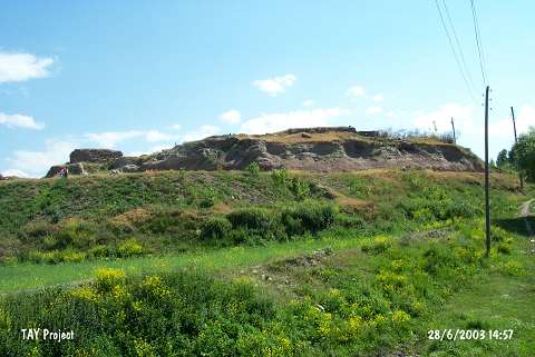 |
|
Type:
|
Mound |
|
Altitude:
|
1670 m |
|
Region:
|
Eastern Anatolia |
|
Province:
|
Erzurum |
|
District:
|
Pasinler |
|
Village:
|
Tepecik |
|
Investigation Method:
|
Excavation |
|
Period:
|
Middle Iron Age |
|
|
|
 |
|
| It is situated in the Tepecik Village, 10 km east ofthe Pasinler District in Erzurum. At present it has been occupied by a modern village. Also, it has been heavily destroyed due to illicit diggings. Sherds dating to the Late Chalcolithic, EBA (Karaz type), Iron Age and Middle Age were identified. It takes place in the registered archaeological sites list prepared by Ministry of Culture and Tourism. |
| Location: |
| Geography and Environment: |
| History: |
| Research and Excavation: |
| Stratigraphy: |
| Small Finds: |
| Remains: |
| Interpretation and Dating: |