|
©The Archaeological Settlements of Turkey - TAY Project
|
|
|
|
|
|
Tosun Höyük |
|
|
For site maps and drawings please click on the picture...  |
For photographs please click on the photo... 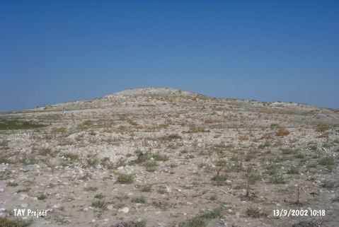 |
|
Type:
|
Mound |
|
Altitude:
|
960 m |
|
Region:
|
Central Anatolia |
|
Province:
|
Aksaray |
|
District:
|
Eskil |
|
Village:
|
Tosun |
|
Investigation Method:
|
Survey |
|
Period:
|
|
|
|
|
 |
|
| It lies 1.2 km south-southwest of Tosun Village of Eskil district; east-northeast of Aksaray Province. It measures 13 m in diameter, and ca. 10 m in height. It was discovered during the Survey of the Nevsehir, Nigde and Aksaray Provinces conducted under the direction of H. Sever in 1990. Although it is a very tiny mound, sherds dating to the Phrygian, Hellenistic, Byzantine and Islamic Period were collected. It takes place in the registered archaeological sites list prepared by Ministry of Culture and Tourism. |
| Location: |
| Geography and Environment: |
| History: |
| Research and Excavation: |
| Stratigraphy: |
| Small Finds: |
| Remains: |
| Interpretation and Dating: |