| ©The Archaeological Settlements of Turkey - TAY Project | ||||||
|
|
||||||
Trapezopolis |
||||||
|
|
||||||
| Ages | Maps | Photos | ||||
| Greek-Roman |
 |
 |
||||
|
|
||||||
|
Type:
|
City | |||||
|
Altitude:
|
m | |||||
|
Diameter:
|
m- Direction: | |||||
|
|
||||||
|
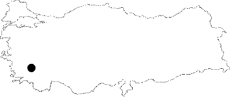
Region:
|
Aegean | |||||
|
Province:
|
Denizli | |||||
|
District:
|
Babadag | |||||
|
Village:
|
Bekirler | |||||
|
|
||||||
|
|
||||||
|
|
||||||
|
TAYEx:
|
- | |||||
|
|
||||||
|
Registration State:
|
Registered For detailed registration information please refer to Turkish pages. | |||||
 |
||||||
| Location: It is located near the Bekirler Village; to the northeast of the Babadag District of the Denizli Province [Simsek 2002:3-4]. |
| Geography and Environment: The city located on the northern slopes of Salbacus (Babadag) overlooks the Lycos plain. It is a known fact that many of the cities located in this valley were involved in textile trading; which was also probably true for Trapezopolis. The administration borders extend to the Meander River to the north; Attouda to the northwest; and Laodiceia to the east. The city is located at the Carian and Phrygian border. |
| Destruction Details: |