| ©The Archaeological Settlements of Turkey - TAY Project | ||||||
|
|
||||||
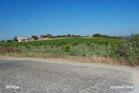
Kemiklihan |
||||||
|
|
||||||
| Ages | Maps | Photos | ||||
| EBA |
 |
 |
||||
|
|
||||||
|
Type:
|
Mound | |||||
|
Altitude:
|
25 m | |||||
|
Diameter:
|
m- Direction: | |||||
|
|
||||||
|
Region:
|
Marmara | |||||
|
Province:
|
Çanakkale | |||||
|
District:
|
Lapseki | |||||
|
Village:
|
Suluca | |||||
|
|
||||||
|
Destruction :
|
Natural causes - Agriculture - Contemporary Settlements | |||||
|
|
||||||
|
TAYEx:
|
Visited - 21/6/2000 | |||||
|
|
||||||
|
Registration State:
|
For detailed registration information please refer to Turkish pages. | |||||
 |
||||||
| Location: |
| Geography and Environment: |
| Destruction Details: The skirts of the mound have been eroded by waves and its surface is planted. A house has been built on the northwestern section and the southeastern skirt is cut by the village road [TAYEx 21.6.2000]. |